Canary Wharf Spatial Study
London, UK
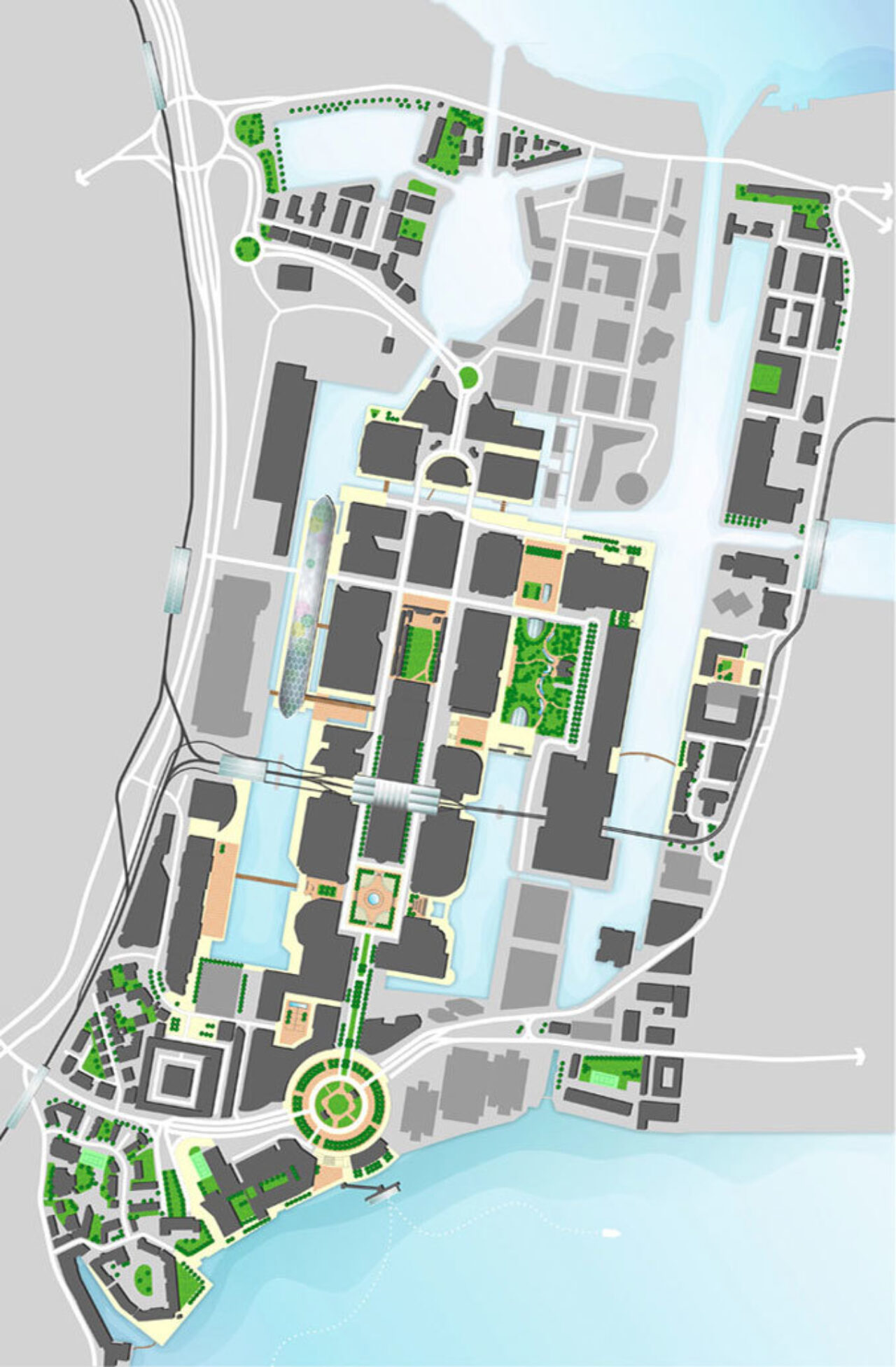
As one of the world’s major financial centres, Canary wharf is a perfect exemplar of brownfield regeneration. Within 30 years, the once derelict Docklands has been turned into a 39ha high quality, high-density, mixed use district with 120,000 work force who work and live in some of Europe’s tallest buildings.
Having reached its originally planned capacity, Canary Wharf aims to expand further by building more efficiently on the remaining land, and attracting more dynamic workforce with improved transport links, in particular, the upcoming Crossrail service. Recent years have seen rapid transformation across the district, with many new high-rise buildings under construction. Despite its continuous success, however, concerns have also been raised about the increasing density and dramatically changed skylines.
WYP’s study is carried out in conjunction with their continuous work on planning new generation of CBD in response to pressing demands for low carbon development and liveable cities in the 21st century context. The study reviews the impacts of Canary Wharf’s development plan, identifies the areas to improve, and explores opportunities to ensure overall coherence and future sustainable growth. Particular attentions were given to assess Canary Wharf’s recent development: integration of mixed uses, quality of public realm, spatial relationships, connectivity, and its unique character.